Map
Fegens fvof
Facilities
Fishing water
WELCOME TO FISHING IN BEAUTIFUL LAKE FEGEN! Lake Fegen where the provinces of Halland, Småland and Västergötland meet. Lake Fegen offers shallow bays, great depths, narrow bays, large open "floods", many islands, smooth cliffs and wonderful sandy beaches. Lake Fegen with no less than 17 different species of fish. Lake Fegen, which is unique in the world for the spring-spawning zander. Lake Fegen with its interesting birdlife. Lake Fegen with its good water quality. Lake Fegen, which is now a nature reserve and Natura2000 area. BOAT PLACES
A concrete ramp and a pier are located at the fire station in the Fegen community.
At Sandvik church, Fegens FVOF has built a new concrete ramp with an associated dock. Please visit our website and read about the construction under ABOUT US, or look at the slideshow under PICTURES. Please respect the parking ban at the church. Boat trailers and towing vehicles may only be parked in the parking lot south of the parish hall. FEGENS NATURE RESERVE In addition to general legislation, Fegen is covered by extended protection: From April 1 to July 31, there is a landing ban on many islands and locations. These are marked with yellow signs and in some cases buoys in the water. From April 1 to July 31, speed on the lake is limited to 5 knots. It is prohibited to make fires or camp, except in specially prepared places. The county administrative boards' websites provide more detailed information about the nature reserve. FISHERIES SUPERVISION Our fishing inspectors carry out random spot checks. During a check you will be asked to show a valid fishing license and identification. DEPTH MAP Fegen is a tricky lake with many shallows and rocks just below the water surface. "Fascinerande Fegen" has produced a depth map of the lake which is available for sale at Alvhaga Vildmark tel 070-5906415. Fegen is regulated and is part of the Ätrans water system. Please note that the water level can vary with an amplitude of 1.75 meters, and the depth map is based on the water level 132.65 meters above sea level. Click on the following link: http://www.vkr.se/Hist/AtrnFegY.htm for information on current water levels.
Species
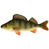
![Abborre]()
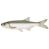
Abborre ![Benlöja]()
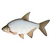
Benlöja ![Björkna]()
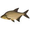
Björkna ![Braxen]()
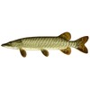
Braxen ![Gädda]()
Gädda Gärs ![Gös]()
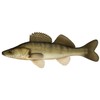
Gös ![Lake]()
Lake ![Mört]()
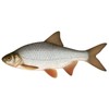
Mört ![Sik]()
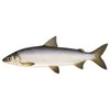
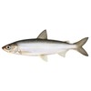
Sik ![Siklöja]()
Siklöja ![Sutare]()
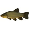
Sutare ![Ål]()
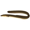
Ål

